Zones of Theoretical Visibility – Powys
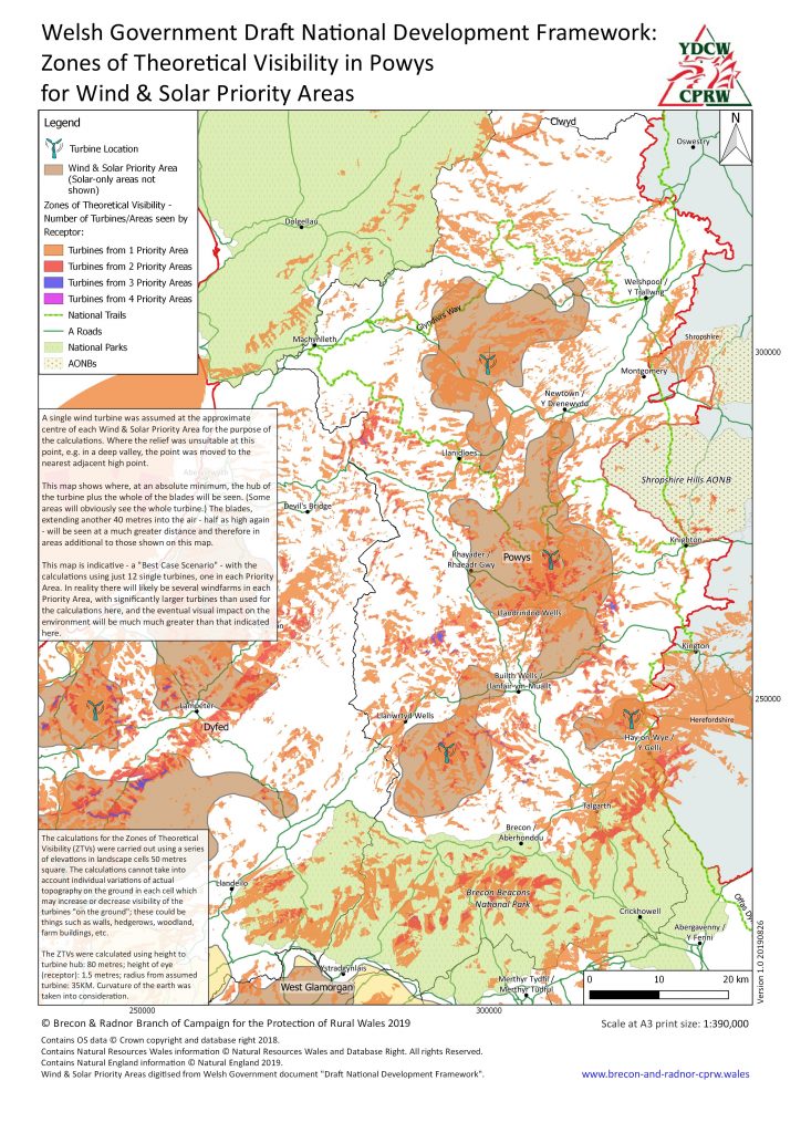
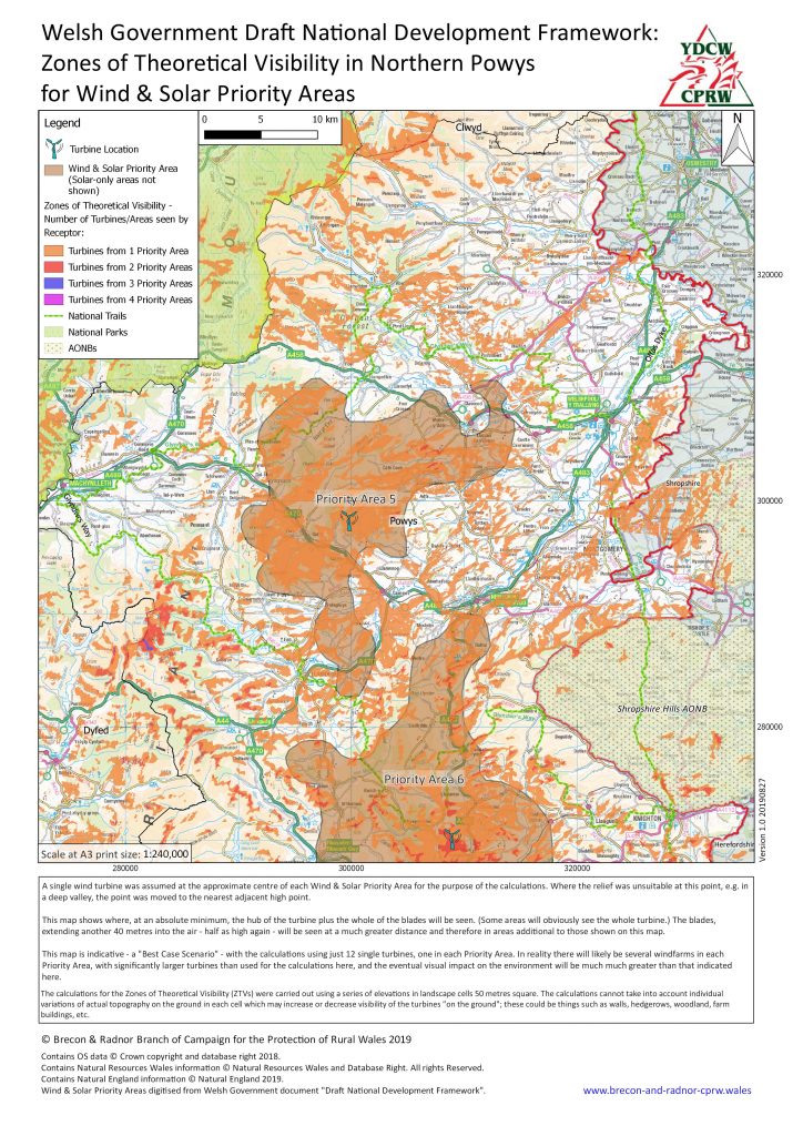
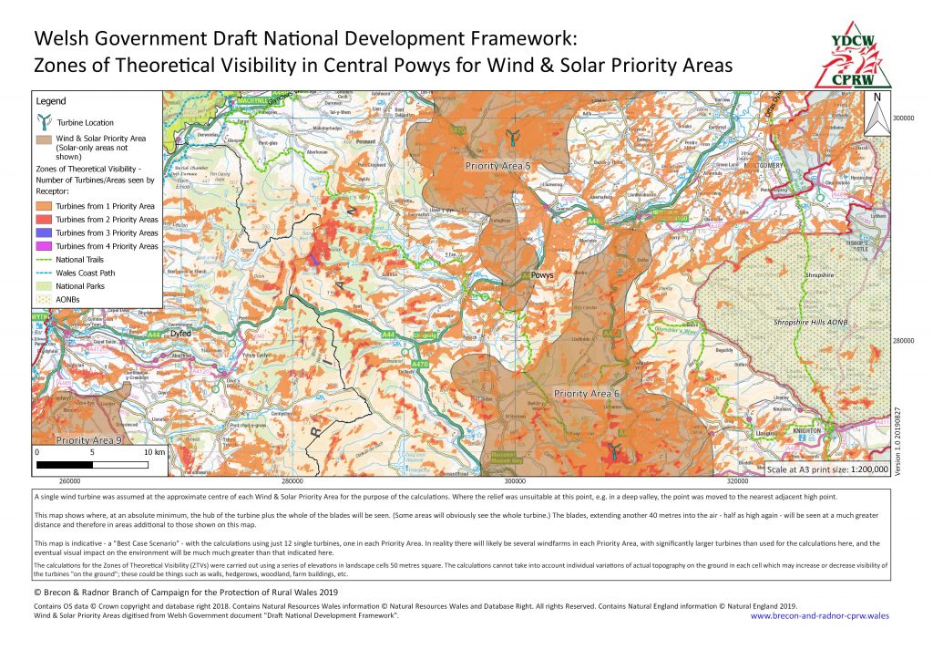
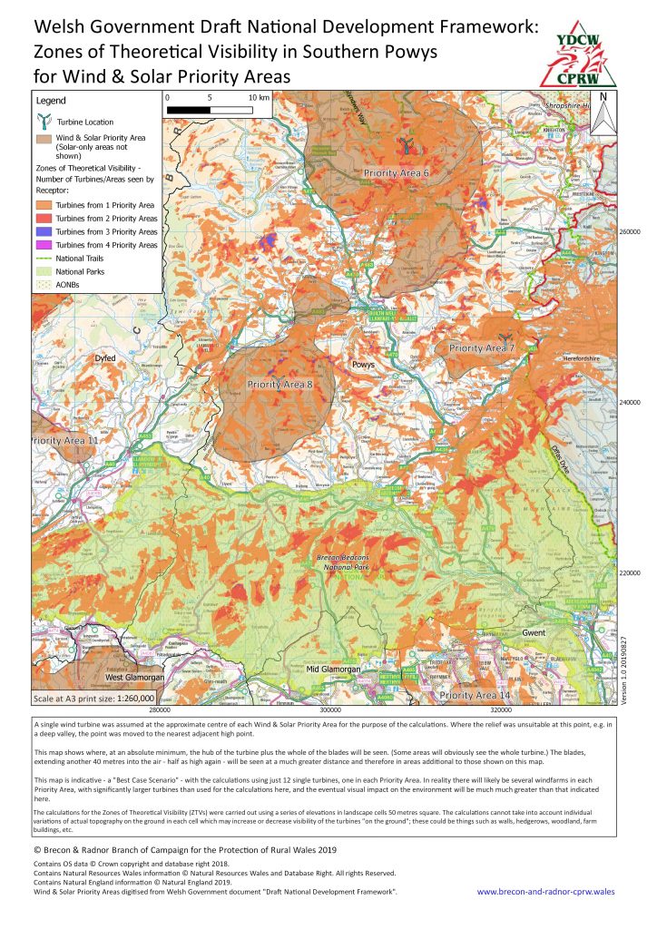
The following four maps show the Zones of Theoretical Visibility (ZTVs) for wind turbines in the Wind & Solar Priority Areas and their effect on Powys. The first is an overview of the ZTVs for the whole of Powys and remaining ones show much more location detail. The overall Wales ZTV map can be seen at the bottom of this page.
The shading on the maps sets out, according to the key, the areas around the county from which wind developments within one or more proposed Priority Areas will be visible. These maps present a very conservative ‘Best Case Scenario’ based on assumptions explained on the maps themselves. In reality the eventual visual impact on the environment will likely be much much greater than that indicated here.
As on that page you may view a larger version of, or download, the following maps as PDFs by clicking on the map or right-clicking and selecting “Save target as” or equivalent.
Notes on the ZTV calculations and assumptions can be found on the maps.


